Cross sections and 3D models built from your own data
Interactive maps, cross sections, report-ready site plans, and 3D subsurface models, generated directly from the same database as your logs, not redrawn by hand.
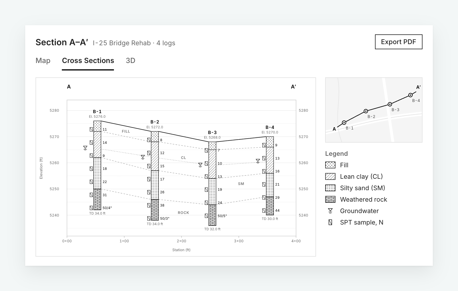
Visualization from the same source of truth
Redrawing a cross section by hand after the logs are already entered is duplicate work, and it opens the door for the drawing and the data to drift apart.
In BoreDM, the map, the cross section, and the 3D model all pull from the same database as the logs. Update a log and the visualization is already current.
What you can generate
Interactive maps
Every boring, test pit, and CPT plotted on a live map of the site.
Cross sections
Generated directly from logged data, not redrawn by hand.
Report-ready site plans
Site plans formatted for inclusion in a stamped report.
3D subsurface models
Build 3D models from your database. Included in Logs Pro.
Civil 3D and OpenRoads
Export DXF and IFC files for Civil 3D, or connect directly to OpenRoads Designer through the WSB-built BoreDM connector.
Current visualizations
Visualizations update automatically as underlying log data changes.
Suggested for you
See your site modeled in BoreDM
Book a walkthrough with our team. After the demo we will set up a trial environment loaded with your project data.